 |
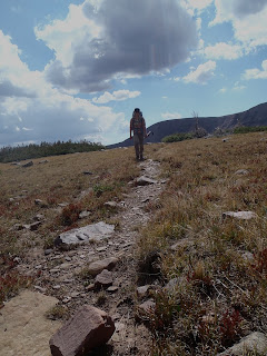
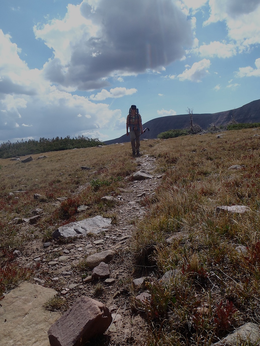
| Oweep Basin |
The Highline Trail has been on our list of things to do for a long time. Recently we completed a 70 mile traverse of the High Uintas Wilderness from Chepeta lake to Mirror Lake Trailhead.
We have made a couple trips to the High Uintas, including some time on the Highline Trail, but always wanted to be in the ranks of the long haul backpackers that have hiked the wilderness from stem to stern.
I spent lots of hours at Sandwash reading and studying maps, and wondering at what the terrain must look like.
 |
| Inspiration |
I made a call to the Forest Service in Duchesne to find out where the sheep were going to be grazing so we could avoid them as much as possible. Amber was most helpful and sent me a link complete with maps outlining the grazing plans. The two areas that were of interest to us would be Oweep Basin, and Painter Basin. As it turned out we didn't see sheep in either of those areas, but did race several hundred sheep and a shaggy dog into the upper reaches beneath the east side of Red Knob Pass. The one area that Amber didn't mention was the heavily cowed area in Rock Creek. We detoured off the Highline Trail, following the Jack & Jill Trail, to avoid spilling altitude then regaining it while crossing the Rock Creek drainage. After 5 hours of stomping through muddy cow shit we finally camped at Brinkley Lake near the bottom of Rocky Sea Pass.


I have spent several years preparing food for week long river trips, including a few month long trips, but never had I prepared food for 9 days of unsupported backpacking. This was an intense planning process that we thankfully started working on several weeks ahead of time. We packed as light as we could think of and made smaller portions of food than we would've liked. We put the minimum in the "go" pile, then, depending on pack weight we'd come back and add to it from the "maybe" pile. The maybe pile had stuff like wine. The "go" pile had stuff like whiskey. Our goal was to begin the trip with packs no heavier than about 25% of body weight. As it turned out mine was 55lb. and Lisa's was 35. Needless to say nothing from the maybe pile went with us.
Obviously, we are by no means ultralight backpackers, and don't really aspire to attain that level of masochism. For us, the point is to enjoy the trail, and the wilderness through which it passes. To sip a little whiskey by a fire in the highcountry while watching the alpenglow light up the surrounding peaks is enjoyable. So if that means my pack is heavier and I'm moving slower because of it then it's worth the trade-off.
We packed 9 days rations, but expected to take about 7 days to complete the trail. The Highline Trail never goes below about 10,000 feet, and due to the season, we expected to be exposed to thunderstorms the entire trip. To help manage that risk we packed 2 days excess food so we wouldn't feel pressured if we needed to stop short a day or two. I've learned that it's ok to assume some risk as long as it's managed.
 |
| Breakfast, Lunch and Dinner for 9 days |
 |
| misc. essentials |
Setting Up:
We drove to the Mirror Lake end of the Highline trail to sleep the night before setting out. Partially to get a head start on meeting our shuttle driver and partially to get a head start on acclimating to the altitude. At about 11,400 feet we parked where we'd sleep on the ground. We ate dinner, sipped a little whiskey, and started reading out loud to each other from the book I brought along. The book, written by Bill Walker, of his
Highs and Lows of the Pacific Crest Trail. That book would prove to be worth it's weight, on multiple occasions, while we were tent bound during cold rainy nights that threatened to blow down the forest. Thanks Bill.
Day 1:
About 7am we parked the car at the Highline Trailhead in a crowed parking area and met,
Stag-man, our ride to Chepeta Lake. It's a good thing we met early because it took us about 6 hours to get to Chepeta. We staggered under our heavy packs and started walking about 2pm with intentions of making it to Brook lake on the other side of North Pole Pass. Neither of us had hiked with trekking poles before, but we were immediately glad we brought them. Slowly the coordination clicked in as we warmed up. After we left the trailhead behind it wasn't long before we were above the trees walking across the rocky tundra toward North Pole Pass. The pass had a false summit or two, but I didn't care. The ominous grey sky wasn't cracking thunder, the country was beautiful, and it felt good to be walking, despite the heavy 9 day load of gear and food. I felt the thin air make my steps slow. I thought about how the trip had finally began and, how at this point, the only way out, was to walk 70 miles across this so called High Uintas Wilderness. As we approached the 12,400' summit of North Pole Pass the reality of what we were doing set in at the same time the chill of the wind gave me goose bumps. The feeling was exciting and it made me smile, and Lisa and I worked hard, as we walked for the next 7 days.
 |
| Chepeta Trailhead |
 |
| Taylor lake - near North Pole Pass |
 |
| Wilderness Boundary - North Pole Pass |
 |
| Brook Lake and Fox Lake: Looking west from NPP |
 |
| Camp 1: Brook Lake |
Day 2:
One of my weight saving ideas was to leave some stove fuel at home in favor of using fire to cook. Little did I realize how this tiring this decision would get. Anyway, we made cowboy coffee and brought our dehydrated bacon & eggs back to life, caveman style, with lake water and fire. We got our usual start at about 10am on a beautiful sunny morning. We made our way back up the hill to the Highline Trail and headed west. A couple hours later we met our first company, west of Fox Lake. They had come up Henrys Fork and over Gilbert Peak, past Davis Lakes, and were headed out to Hoop Lake. Somehow, they pegged us right away as "Highline Hikers". We continued without seeing anyone else all the way to Painter Basin, where we camped near a small stream. As we descended into Painter Basin it was raining across the valley and making the cliffs shine near Trail Rider Pass, which was wonderful. We got into our first steady rain of the trip just as we got to camp so we made our dinner under the rain fly and read about Skywalker. After dinner we sat by the stream and sipped some whiskey watching the alpenglow illuminate the desolate rocky eastern face of Kings Peak, and Anderson Pass where we would spend most of the rest of the next day.
 |
| rainy cliffs near Trail Rider Pass |
 |
| Camp 2: Painter Basin |
Day 3:
The next morning was spent drying stuff in the sun before leaving. No fire last night or this morning made for a reality check in the fuel supplies. We had oats with powder milk and dried blueberries. We both woke with a headache for the second morning in a row, but it quickly went away with some water and coffee and breakfast....at least I thought.
A few miles up the trail, we left Painter Basin, climbing a low ridge toward the Anderson Pass/Gunsight Pass trail junction. We stopped for a break and Lisa told me that her headache never went away this morning. I thought about our trip to Alta Toquima in 2012 and almost shit my pants as I looked at the GPS and saw we were over 11,000'. I thought about our options to get down. I quizzed her annoyingly about nausea, which she assured me was not a problem. Lisa had a Clif Bar and took the lead to set a pace she was more comfortable with. I was admit-ably setting a fast pace because I was worried about getting over Anderson Pass before thunderstorms set in. After Lisa took the lead she had no problem, and was her usual chipper self as we ascended to over 12,500' at Anderson Pass where we ate some lunch. I was so relieved. The only times we've ever had altitude problems is when we ascend too fast and we both knew that ahead of time.
The summit of Kings Peak was full of day hikers despite really nasty looking clouds all around. At Anderson Pass we traded photo taking duties with some other through hikers that we met down the pass. They were on an 8 day trip, and had a 13 year old dog with them who was getting along like a champ. After the pass we headed down into the headwaters of the Yellowstone to find a camp. We got caught out in a nasty thunderstorm with wind driven hail and cold rain. We ended up taking a spot that wasn't really a camp, but it worked. We set the oversized tent fly which we bought with this sort of situation in mind. That is; where we could retreat, with all our gear, when things were to get rough. We dried off, changed clothes, made some ramen soup, read about Skywalker, and waited it out. It was wonderful!
Later in the evening the rain quit so we emerged from our nylon dome and made a smoky fire on which to cook our dinner. I've found that the dehydrated food is much more tolerable, short and longer term, if it's thoroughly cooked. Depending on the food, I like to let things simmer for 30 minutes or so. Obviously, simmering on the stove for 30 minutes isn't practical since it'd use too much stove fuel, hence the need for some caveman style cooking on the coals. We made un-vegi-chili with rice, by adding some dehydrated turkey, a good chunk of cheese leftover from lunch, and some dehydrated pepper seeds. It was spicy, salty, gooey and wonderful, but probably never would've been eaten at home. But, there-again, the view of Kings Peak and South Kings Peak, across the headwaters of the Yellowstone, doesn't exist at home either.
 |
| Trail junction: leaving Painter Basin |
 |
| Approaching Gunsight Pass junction |
 |
| Kings Peak from Anderson Pass |
 |
| Anderson Pass and Yellowstone Headwaters |
 |
| Anderson Pass: west side trail |
 |
| Camp 3: Yellowstone Basin |
Day 4:
During the night I woke a couple times and peeked outside to see if we had cloud cover, or stars. It was mostly cloudy all night and we woke in the morning to clouds blocking out the sunrise. By the time we finished breakfast the sun had broken through and was warming and drying things nicely. After getting everything dried out and packed up we got on the trail about 9:30. We stopped an hour or so later at North Star Lake to take a break and switch socks. By now we had been in enough rain to have wet boots, which we knew were a recipe for blisters especially with so many miles yet to go. We tried drying socks over the fire and sleeping with them, but we still had a pair each that were damp enough to cause blisters. We switched them out every hour or so and hung the wet ones (when it wasn't raining) to dry in the wind on the outside of our packs. The plan worked good enough to avoid blisters, as it would turn out, for the rest of the trip. The break at North Star was anxious and short as we watched the thunderheads build over the pass that we were to ascend.
After we started going again we met an east bounder on horse back with a couple dogs. He was solo and trying some new country to the east. He quizzed us about Anderson Pass and points east, and we quizzed him about Porcupine, Red Knob, and Dead Horse. 10 minutes after we parted company it was a neat perspective (like an IMAX film) to turn and watch him ride away, down the valley, towards North Star. It is such a big treeless expanse of country that by adding something for perspective was humbling for sure.
We made the summit of Porcupine in a cold wind about noon, and didn't hang around long. The trail off the west side of Porcupine Pass would prove to be the most exposed and scary part of the whole trip. Oweep Basin below would prove to be bitter-sweet. The scenery was my favorite part of the trail, but the thunderstorm we got into in Oweep scared the absolute shit out of me! On crossing Oweep we were pounded deaf with marble size hail stones, and the lightning was hitting real close. Less than 2 seconds between the flash and boom. I couldn't imagine that crouching to the ground would've been any better than being upright, and staying off of promontory pieces of ground. So we walked...fast and anxious, and felt like sitting ducks in a shooting galley at a redneck carnival! After the storm passed we were wet and cold, and silently kicked out miles to stay warm. I don't know what Lisa was thinking, but I was scared stiff; worse than I had been in years, and silently walking it off felt good. The country was even bigger now between Oweep and Lake Fork and was beautiful beyond what our shitty camera could've served justice, so I didn't even try. It was one of those moments of The Wilderness to enjoy, for the moment, rather than messing around trying harness it. Thankfully the rain quit long enough for us to dry out as we walked toward our destination at Lambert Meadow.
 |
| Lisa, Tungsten Lake, and Porcupine Pass |
 |
| Working west - towards Porcupine Pass |
 |
| Porcupine Pass |
 |
| Un-named range - Oweep Basin |
 |
| Oweep - moments before wild lightning |
 |
| Camp 4: Lambert Meadow |
 |
| pot-o-gruel and a rainy night in the hooch |
Day 5:
After another rainy night, again, we set everything out to dry. We didn't get going until 10:30, which I knew would set us up to be climbing Red Knob Pass in the afternoon. With the Oweep Basin thunderstorm freak out session fresh on my mind we decided that we'd stop in the upper reaches of Lake Fork to have lunch and re-evaluate whether or not we'd ascend the pass. The plan was that if there was any thunder, at all, we'd stay in the trees and wait, possibly until the next day. After-all, situations like this were exactly why we were packing enough food to extend the trip if need be. As it turned out we had the most beautiful day of the entire trip.
While ascending Lake Fork valley we were in the company of several hundred sheep that were doing an efficient job of screwing up water quality as they ascended the valley. The sheep delayed our lunch plans, since we didn't want to hang out in the fresh sheep shit. As we neared the top they finally veered east beneath Lovenia so we went west and had a much delayed lunch on the tundra beneath Red Knob Pass, still in proximity to a lightning safe camping area, whatever that is.
Delaying lunch, for whatever reason, during such periods of caloric burn is generally bad for ones mood as Lisa clearly let me know. One of the useful places on the internet that I found pre-trip was a site to estimate caloric needs during this trip. The amount of calories that we were to expend was impossible to replenish daily, which was fine for a limited amount of time, but we knew that it'd be the anticipated source of a bad mood once in a while. The
once in a while came for Lisa as we tried to get a non-sheeped lunch spot. Anyway, food fixed everything and I watched amazed at the absence of thunderheads over Red Knob.
We finished lunch and a sock change session, then went for the pass, hoping our luck would hold out. Our luck held, and the views on top were the best of the trip. To the west was Dead Horse Lake with it's characteristically luminescent glow that would be our destination for the night. Red Knob Pass is where the Highline trail enters the north slope for the only time of the trip. For some reason the mountains seemed more jagged here than at any other place on the trail.
Once down into the headwaters west of Red Knob we filtered water out of a stream that probably didn't need to be filtered. After our race with the sheep, and a crossing of Red Knob, we were both out of water. We took a long break in the warm sun, tall grass, and flowers. After our break we enjoyed the walk through the wet forest and compared to it our native Northwest as we approached Dead Horse Lake. Dead Horse was my favorite camping area of the trip, but it was a drag to see that people had left trash. As we approached the lake, from down the hill, we were greeted with the azure color at eye level. It was a spectacle and a wonderful end to the days walk. We were elated to be at camp and to have had a sunny day. We dropped our packs and soaked our feet in the lake where we watched a trout swim up to us to investigate the strange behavior of someone not trying to catch him. We filtered more water, and sipped some whiskey, as the alpenglow lit up the surrounding peaks. We then built a fire, and simmered our pot of grub over the coals, as the stars welcomingly took over the sky.
 |
| Explorer Peak from near Lamber Meadow |
 |
| Lovenia from east of Red Knob Pass |
 |
| working across the tundra towards Red Knob |
 |
| Explorer Peak east of Red Knob |
 |
| Lovenia from Red Knob Pass |
 |
| trail of many carins |
 |
| Camp 5: Dead Horse Lake |
Day 6:
The nice weather would prove to come to a screeching halt during the night with the pitter-pattering of rain on the tent fly. The next obstacle would be Dead Horse Pass that had a reputation of infamy due to it's exposure and steep trail. The current rain we had wasn't a thunderstorm, but was enough to soak the trail, which we guessed would make the exposed sections even more treacherous and slippery. We decided to wait it out in the tent and amuse ourselves with Bill Walker's book for company. We finally got out of camp around 2:30. As it turned out Dead Horse Pass was definitely exposed, but not any worse than Porcupine Pass was. We made our way slowly to the top where we were met with a cold breeze and views west into the deep timber of Rock Creek and the south slope. We had a late start and were letting the afternoon weather decide our plans for camping. The weather wasn't great, but it wasn't storming either so we walked until around 7:30 to a camp at Brinkley Lake.
During our trip planning we gained beta that it may be a better idea to walk the Head of Rock Creek Trail rather than dropping into and climbing out of Rock Creek. We followed the Jack and Jill trail around Rock Creek, which was a cowed out shit-hole, and a bad choice! I was glad I had my
ankle gaiters. If I had to make that call again I'd probably do the longer route all the way around the Head of Rock Creek.
It looked like it'd been raining a lot at Brinkley. All the wood was wet and took a while to get some fire going. It was well past dark by the time dinner was ready and we finished the last sips of whiskey while Cassiopeia wished us good luck with the trips end. As our blackened pot of non-vegi-chili dinner simmered on the coals we talked about trips end for the first time. We were somewhere around 10 miles from the trailhead at Mirror Lake Highway. Lisa suggested we see what the weather was like tomorrow before we decide if we would finish the trip. We stayed up late, made some steamy cocoa and watched the stars on what, we did not know, would be the last night of the trip.
 |
| Dead Horse Pass Trail |
 |
| Dead Horse Lake |
 |
| Dead Horse Pass namesake |
 |
| Dead Horse Pass |
 |
| view toward Red knob |
 |
| Camp 6: Brinkley Lake |
Day 7:
In the morning it was raining again so we made a pot of cowboy coffee in the vestibule and read about Skywalker. After a couple hours the rain let up long enough for us to pack. Everything, but the fly was dry, but we packed anyway to start the trek over Rocky Sea Pass. We both silently knew this would be our last day. The rambunctious wilderness of cloudy sky held steady for us until we made the summit of Rocky Sea Pass. The view west let us know immediately to rig for another storm. On the way down from the pass we passed a couple of east bounders who weren't pleased with the weather. By the time we got off the west slope of Rocky Sea Pass the rain was steady and cold. The pass was now in a thick fog, and looked like it could snow at any moment. We found a great little lunch spot under a big spruce that was dry as a bone. We were glad we were down, and hoped that those guys were prepared. We passed Pigeon Milk Spring and marveled at what a terrible name for such a beautiful place. The trail was flooded and the going was full of slippery, mud and rocks for nearly 10 miles to the end. We stopped several times to savor the feel of a 7 day wilderness immersion, and to dread it's coming end. We saw more people on the last few miles than we saw the rest of the days, combined.
 |
| view east from Rocky Sea Pass |
 |
| Mile 70 at Highline trailhead - Success! |
On conclusion:
There's not much we'd do different about this trip. We never felt in too much of a hurry, and thanks to the extra two days supplies we packed always felt like we could wait out the weather if we needed to, but we never really needed to that bad.
The heavy packs made us slow, but why would we want to hurry through such an amazing experience.
Apologies for the crappy photos, we still haven't figured out our
camera. It did otherwise perform like champ after being repeatedly soaked for most of seven days, and doing a couple face plants off of rock carins while trying to do timed photos.
Our
tent was an annoying design, to put it mildly, but kept us dry during challenging weather. The extra size was nice to be able to keep our gear dry too. It was brand new for this trip and thanks to REI for expediting the footprint from Grand Junction. It arrived the day before we left home.
Trekking poles are wonderful! I don't even know how many times they saved my ankles.
The whole time I was out there I was thinking how glad I was to be there, despite the rain and hail. It all brings to mind an excellent quote that I think is very be-fitting.
Some people walk in the rain, others just get wet. - Roger Miller


No comments:
Post a Comment